This structure will be 15ft x 25ft. The enclosed wall surfaces will be transparent and developed in the future for educational interpretation. Participants are spending the week learning wood working and joinery techniques that were used in the 18th century.
Based on information derived from archaeological excavations, we will be recreating the framework of a dwelling that would have been lived in by Menokin’s field slaves.
DAY ONE: The Work Begins
A view of the slave quarters site from the Visitor’s Center.
Craig Jacobs, proprietor of Salvagewrights Ltd. is leading the workshop.
In the interest of time, large cuts are started with the use of power tools.
The detailed joinery work is done by hand.
Hammers and chisels are used to gouge out the fittings.
Measure twice. Cut once.
Tools of the trade
Draw blade
Lots of lumber. Smells wonderful at the work site.
MAKE SOMETHING WITH YOUR MIND
THE MENOKIN GHOST STRUCTURE serves as a physical metaphor to foster discourse and assist people in forming and participating in conversations about slavery as it relates to the Menokin site, the history of America and current events.
MEMORIA is a Latin term, and can be translated as “memory.” Memoria was the discipline of recalling the arguments of a discourse in classical rhetoric. Creating outline structures of the major arguments of a discourse would also aid memory.
KAIROS dictates that what is said must be said at the right time. In addition to timeliness, kairos considers appropriateness. The term also implies being knowledgeable of and involved in the environment where the situation is taking place in order to benefit fully from seizing the opportune moment.
The size of the building is known from the archaeological evidence. However, because there are no photographs of it, we are recreating only the timber framing of the structure, which will be clad in a transparent sheath. We are calling this building the Ghost Structure: Memoria and Kairos.
The design, drawings and renderings of the Ghost Structure were created by architect Reid Freeman, who also serves on the Menokin Board of Trustees.
True to our unique vision, we are not creating a reproduction of a slave dwelling, but instead a constructed form that will generate dialog about our past, with the flexibility to garner new knowledge, awareness and understanding. Once completed, this structure will be used as an educational classroom, and will serve as the centerpiece in telling the African American story – both past and present – in Richmond County, Virginia and beyond.
Thank you to everyone who has touched, or been touched by, Menokin in some way in 2017. We have had a remarkable year of growth and planning. Our programs are reaching more people than ever and we experienced a record number of visitors.
Now, during this season of celebration, it’s important to pause for quiet and mindfulness. Take a different path. Appreciate the timeless workings of nature transitioning to another season.
We offer you the gift of Menokin. It’s all here waiting for you. The road less traveled by.
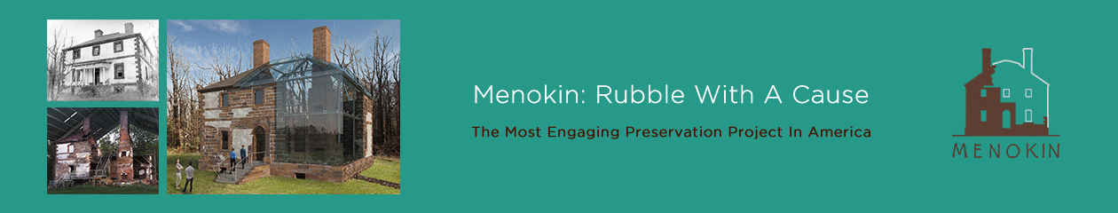
This month, students from Essex Intermediate visited Menokin to learn why cultural institutions like ours are part of the Rappahannock River Valley Watershed. This is more than a STEM program, and a state initiative to give every 6th grader a MWEE, “meaningful watershed educational experience” it’s STEAM: Science, Technology, Engineering, Arts, (or Architecture as we like to say) and Math. And at Menokin, we demonstrate these important ways of learning every day.
STEArchitectureM – Human StairsSTEArchitectureM – Human Arch
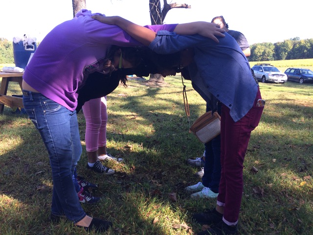
Students get to visit the site and have a real water experience in a canoe on Cat Point Creek; walk the trails and learn about this special habitat; take a Hard Hat Tour and learn about the cultural history of this property, and it’s relationship to where they live.
Heading out on Cat Point Creek.
Why is Menokin involved in a program about watersheds? Because our site has a history that goes back thousands of years. Did you know that, while our continents were forming, and waterways and mountains being created, that Menokin was always on high ground? People have lived here for a long time because of its rich natural resources, that have always made it a desirable place to live.
ScienceTArtM: Grinding soil pigments.ScienceTArtM: Painting with soils.
Our house is a couple of hundred years old, yet the high-ground of our landscape is thousands of years old and inhabited my many for thousands of years before English settlers ever arrived. Our house may be the largest artifact we have of recent cultures, but our ground is deeply embedded with the cultures of many before Captain John Smith ever arrived. Yet, he carried on the identity and heritage of the Rappahannock Tribe, by using their word for this special place, Menokin, which we still call it today, in the 21st century .
Menokin, a 500 acre classroom connecting the past to the present. Come visit for yourself, connect with your world, and be inspired.
Menokin Trustees Tom Duckenfield and Ro King at the Menokin Sleepover Conference.
Last weekend, 23-24 September 2017, I had the fortune to partake in the Menokin Sleepover Conference from the unique perspective of a Menokin Trustee, as well as from the various perspectives of a descendant of Virginia Northern Neck African American slaves, free African Americans, and White slaveholders.
Featuring facilitators Frank Vagnone (One Night Stand) and
Joseph McGill (The Slave Dwelling Project) in their first joint project, the Conference fostered an incredible amount of dialogue and reflection about Menokin, the home of Francis Lightfoot Lee, a Signer of the Declaration of Independence, and his wife, Rebecca Tayloe Lee of Mount Airy Plantation.
After an authentic mid-19th century open-fire meal, Vagnone and McGill facilitated a lantern-lit discussion among the Conference participants about Menokin’s historic inhabitants; its current stewards; its mission, its intrepid melding of colonial architecture and modern glass structural building techniques; and its potential role as a catalyst of racial understanding, reconciliation, and unification.
Following the riveting discussion, several participants and I emulated Vagnone and McGill by pitching tents amidst the Menokin House ruins or in the nearby sward where the former Menokin slave dwellings once stood. At first, my immediate impression was that I was just experiencing a familiar camping-out experience under a clear star-spangled sky, not unlike those of past scouting trips, school outdoor adventures, Army bivouacs, or family mountain getaways.
Tents pitched on the site where Menokin slave dwellings once stood.
As I gazed at the twinkling constellations and reacquainted myself with camping accoutrements, it suddenly dawned on me that this was not an ordinary camping experience at all. Rather, the purpose was to contemplate what it would have been like to be an inhabitant or visitor in a Menokin slave dwelling or in the Menokin House.
Accordingly, via a time and memory conduit constructed by interlacing the “rings” of my family tree with www.ancestry.com DNA dendochronology, I traveled back in time to 1792 — the penultimate year of the second term of Northern Neck son President George Washington – and I began to imagine what several of my Northern Neck ancestors might have been doing then at Menokin.
Portion of Richmond County, Virginia 1818 “List of Free Negroes and Mulattoes” enumerating John Newman, emancipated in 1791 by Robert Carter III.
First, I conjured up the image of my 4th great-grandfather John Newman, who was born a slave in 1770 at Nomini Hall in neighboring Westmoreland County and freed in 1791 by Robert Carter III (1727-1804) as part of the latter’s manumission of more than 500 of his slaves. There are references in peripatetic tutor Philip Vickers Fithian’s Diary about Robert Carter III and his visits to Menokin.
Still savoring his newly acquired freedom, my ancestor John Newman may very well have spent many nights visiting friends and relatives in the Menokin slave dwellings, an example of how many ante-bellum African American families — similar to today’s mixed status immigrant families — had members of mixed free and slave status.
Second, I thought of my fifth great-uncle Moses Liverpool, who was born in 1773 as a slave of Lt. Col. William Fauntleroy (1716 – 1793) on his “Old Plantation” in Naylors Creek, a short paddle ride up the Rappahannock River from Menokin, which is located along the shoreline of Cat Point Creek, a tributary of the Rappahannock River.
Because Moses was described by the Fauntleroy family as “… a very smart, smiling fellow, who is a good cooper, a house carpenter, and ‘a little acquainted’ with the ships’ carpenter business,” I imagined Moses might have spent a few night in the Menokin slave dwellings, perhaps having been hired out to Francis Lightfoot Lee to create or repair Menokin House’s interior woodwork or, alternatively, to build or repair the ships, casks, barrels, and hogsheads used to transport commodities produced at Menokin.
Third, I contemplated how my White slave-holding ancestor Henry Lee III (1756-1818) — my 2nd cousin, 8x removed and known as
Maj. Gen. Henry “Light Horse Harry” Lee.
“Lighthorse Harry” because of his daring in the Revolutionary War — might have spent an evening with his cousin Francis Lightfoot Lee. Henry III’s great-grandfather, Henry Lee I, was a brother of Governor Thomas Lee (1690-1750), the builder of Stratford Hall in neighboring Westmoreland County, Virginia, and Governor Thomas Lee was the father of Francis Lightfoot Lee of Menokin. Henry Lee III married his distant cousin Matilda, granddaughter of Governor Thomas Lee, niece to Francis Lightfoot Lee, and heiress to Stratford Hall.
On the canvas of my mind, I painted a picture of Henry Lee III dining at Menokin in 1792 with his cousin Francis Lightfoot Lee and Francis’ brother Arthur Lee (1740-1792), a physician and opponent of slavery in Virginia, who served as an American diplomat during the American Revolutionary War. I considered that, among other topics, these cousins may have debated slavery and the tension and cognitive dissonance between the institution of slavery and the ideals of the Declaration of Independence, which expresses:
“We hold these truths to be self-evident, that all men are created equal, that they are endowed by their Creator with certain unalienable Rights, that among these are Life, Liberty and the Pursuit of Happiness.”
Taken together, the fervent and introspective discussions of the Menokin Sleepover Conference participants, my own musings concerning how some of my racially diverse ancestors may have inter-related with Menokin, and the social, political, and economic issues revolving around it, Menokin occupies a singularly unique position.
Menokin can not only be the focal point and catalyst for preserving and rebuilding a national historic landmark, but also be the focal point, catalyst, and host of future conferences – a la the Aspen Institute — to foster discussions that can promote understanding and reconciliation to dissipate the long shadow of slavery by actualizing the shining ideals of the Declaration of Independence signed by Francis Lightfoot Lee and 55 other American patriots.
Last week, the 6th grade class of Westmoreland County Middle School visited Menokin as part of the TOTS (Think Outside The Sink) program. TOTS is one of several programs that make up the Meaningful Watershed Experience Program that is a joint venture between several natural resource conservation projects in the Northern Neck.
The class divided itself along the gender line, so while the boys started over at the house, the girls took place in an interactive math and graphing experiment design to measure the volume of water in a riverbed.
This involved….MATH. And…..SCIENCE. And……CRITICAL THINKING. And, to be fair, a good amount of GIGGLING (these were 6th grade girls, remember).
The exercise worked like this. The girls formed two rows (representing flowing water sources) that converged at a few points and eventually narrowed into one end point. The flowing water was made up of dried beans, which were passed from person to person, heading downstream at a quick pace. The people at the convergence points had the toughest job – receiving beans from two directions and then trying to get them on their way downstream at the same time. Naturally, a lot of beans got dropped at these points, which represented the tendency of water to overflow or flood at these points when the volume is greater than the channel.
What thrilled me beyond all measure was that they were ALL participating. No one was hanging back. No one whining about being bad at math or science.
I wished out load that the beans were magic and would grow a beanstalk so we could steal the golden goose and fund our building project. This daydream led to the naming of their project as The Menokin Magic Bean Stream.
The beans that made it all the way downstream were counted and subtracted from the original starting number. This information was calculated by season and other variables. That data was then plotted on a bar graph to visually represent the information gathered.
I was so thrilled to watch our STEAM program at work and targeting the demographic of students that is traditionally left behind in this kind of study. I would like to thank these girls and their mentors and teachers for taking advantage of our education programs at Menokin, and for making my day!
Find out more about our education programs and initiatives on our website.
Originally prepared in October 2012 and revised in November of 2013, this research conducted and prepared by C. Allan Brown is part of the The Menokin Glass House Project.
The report will be shared in a serial fashion with the intention of a weekly post as time allows.
PART III
Immediately south of Stephens’ property, (see Part II) Thomas Beale II settled on 929 acres at Chestnut Hill about 1673.[1] Like Fleete and Fauntleroy, Beale had true Cavalier origins which gave this neighborhood even at its earliest settlement an incongruous aristocratic air amid a near wilderness. His elegant tombstone (probably carved in England c. 1680) is emblazoned with the family’s coat-of-arms and was the oldest standing marker in the county until it was recently removed from Chestnut Hill for safekeeping.[2] (Further research on Chestnut Hill plantation, especially deeds and plats, may provide clues for understanding Menokin better in relation to its roads, fields, etc.)
Figure 7
It seems likely that the earliest “road” to Menokin entered from what became the Chestnut Hill property to the south and originally may have been an Indian path linking the sites of the so-called “ Mt. Airy burials” and the “Town of the Great Rappahannocks,” both identified on Figure 7. Keep in mind that in the mid-seventeenth century most travel in the vicinity was by water routes. Even so, the open character of the understory did not impede travel through the virgin forests. Robert Beverley in 1705 described the “Oaks, Poplars, Pines, Cedars, Cypress and Sweet-Gums; the trunks of which are often Thirty, Forty, Fifty, some Sixty or Seventy foot high, without a branch or limb.”[3] Using GIS technology, the Virginia Department of Forestry has located
Fig. 11. Road traces at Menokin as identified by the Virginia Department of Forestry
a trace (which it judged to be “over 250 years old”) that “extends from the high ground at Menokin . . . south, southeasterly and today terminates in Muddy Run marshlands” (see Fig. 11).[4] In the 17th century, that track likely crossed Menokin “swamp” below a beaver dam that had accumulated there.
The initial “opening” (i.e., clearing and cultivating) of land at Menokin occurred perhaps as early as the late 1650s, following John Stephens’ 1657/58 patent of the original 1,000 acres.[5] Of course, the Rappahannocks, if indeed they were resident there, may have cleared and cultivated part of the land prior to Stephens’ patent.[6] Stephens returned to England for a brief period (c. 1662-1664?) and after his death in 1678, his heirs sold the property to John Grymes of Gloucester County in 1685.[7]Grymes eventually owned sizable acreage in Middlesex, King and Queen, and Richmond counties, as well as his home plantation in Gloucester.[8] At his death in 1709, Menokin passed to his second son Charles Grymes along with another plantation, Morattico, lower down the Rappahannock River.[9] Charles Grymes was among the foremost gentry planters in early eighteenth-century Virginia and erected an imposing residence at Morattico (but like Fauntleroy’s, too near the river!).[10]Grymes operated Menokin as an outlying “quarter” with 17 slaves, 36 cattle, 32 sheep, and 56 hogs, according to a 1743 inventory.[11]
Grymes’ son-in-law and daughter, Philip and Frances (Grymes) Ludwell inherited Menokin about 1750, after a protracted settlement of Charles Grymes’ substantial estate; yet they soon sold the property to John Tayloe II who already owned much land nearby.[12] In 1751 when he acquired Menokin, Tayloe was one of the wealthiest gentlemen in Virginia.[13] However he had not yet begun to build his impressive new house at Mount Airy (constructed c. 1761-1765) and it seems noteworthy that he passed over the opportunity to establish his seat at Menokin.[14] (For the location of Tayloe’s earlier house, see Fig. 10.) Indeed, he continued to operate Menokin as but one of a number of outlying quarters until he gave the property to his daughter, Rebecca, and her husband, Francis Lightfoot Lee.[15] Thus, by the early 1770s when Menokin at last became a principal residence, its lands had been in the process of being cleared and cultivated, to some unknown degree, for more than a century.
That circumstance surely influenced the site-planning decisions made by the Lees and their generous benefactor, her father, John Tayloe II. It seems logical to assume that the approximate 1,000 acres of Menokin were first “entered” and “opened” from the south; with sequential clearing of the several, adjacent plateaus proceeding generally northward over time. A chronicler of agricultural practices in late colonial America explained why large tracts were required for tobacco cultivation, in the constant search for “fresh” fields as old ones were exhausted of their fertility: “This want of land is such, that they reckon a planter should have 50 acres of land for every working hand.”[16] A field typically was considered “worn out” after 3-4 years of tobacco cropping; and required about 20 years lying fallow to regain its fertility.[17] Selective felling of the most useful hardwood trees within the surrounding ravines (yet with care not to denude the “highly erodible soil”)[18] had likely also been ongoing for some decades. The extensive canebrakes of the adjacent tidal marshlands may have been left largely intact until the nineteenth century. Most significantly, an existing pattern of fields, fences, and (at least rudimentary) roads no doubt was already in place by 1769 when Menokin house was begun. And, of course, the resident laborers long had known it as their home (some for perhaps more than one generation).[19]
[1]Virginia Land Office Patent Book 6, p. 24. The plantation remained in the Beale family through the early nineteenth century.
[3] Robert Beverley, The History and Present State of Virginia ed. Louis B. Wright (Chapel Hill, 1947), pp. 123-124.
[4]Virginia Department of Forestry, “Forest Stewardship Plan for Menokin” (July 2002), p. 28.
[5]Wells, “Menokin in Time,” p. 8.
[6] For native American agricultural practices, see Michael Williams, Americans and Their Forests: A Historical Geography (Cambridge, U.K., 1989), pp. 35-43.
[7] Wells, “Menokin in Time,”., pp. 8-9.
[8] Ibid., pp. 10-12.
[9] Ibid., pp. 12-13.
[10] For information on the elegance of Morattico, see Thomas Tileston Waterman, The Mansions of Virginia, 1706-1776 (Chapel Hill, 1945), pp. 62-67, 409-410.
[11]Wells, “Menokin in Time,” p. 14.
[12]Ibid., pp. 14-15.
[13]See Laura Croghan Kamoie, Irons in the Fire: The Business History of the Tayloe Family and Virginia’s Gentry (Charlottesville, 2007), p. 33.
[14] See William M. S. Rasmussen, “Palladio in Tidewater Virginia: Mount Airy and Blandfield,” in Building By the Book ed. Mario di Valmarana (Charlottesville, 1984); Camille Wells, “Dower Play/Power Play: Menokin and the Ordeal of Elite House Building in Colonial Virginia,” in Constructing Image, Identity and Place ed. Alison K. Hoagland and Kenneth A. Breisch (Knoxville, 2003), pp. 2-21. William Tayloe, the original settler, had built a house nearer to the Rappahannock River, about 1682; it reputedly burned in the early eighteenth century.
[15]Wells, “Menokin in Time,” pp. 18, 28.
[16] Harry J. Carman, ed., American Husbandry (London, 1775; reprint, New York, 1939), p. 165. See also Lois Green Carr and Russell R. Menard, “Land, Labor, and Economies of Scale in Early Maryland: Some Limits to Growth in the Chesapeake System of Husbandry,” Journal of Economic History v. 49 (1989), pp. 407-418; Paul G. E. Clemens, “The Operation of an Eighteenth-Century Chesapeake Tobacco Plantation,” Agricultural History v. 49 (1975), pp. 517-531. At Menokin, the most productive soil has been considered to be the Kempsville Sandy Loam found as the topsoil of the upper plateaus. For an interesting account of period clearing practices, see Carville V. Earle, The Evolution of a Tidewater Settlement System: All Hallow’s Parish, Maryland, 1650-1783 (Chicago, 1975), pp. 30-34.
[17] Earle, Evolution, p. 25.
[18]Wildlife Service, “Rappahannock River,” section 3-2. This is the Rumford soils of the slopes.
[19]Camille Wells has noted that listings of slaves by their given names “suggest that when [John] Tayloe arranged to buy Menokin in 1751, he agreed to buy its inhabitants as well,” idem, “Menokin in Time,” p. 18. (See also Ligon Brooks’ research notes in Menokin Foundation files.)
How thrilled were we when Richard Moncure, Education Director for the Friends of the Rappahannock (FOR), called to see if he could bring some members of Falls of the James, – Sierra Paddlers Club from Richmond – for the first spring paddle on Cat Point Creek on April 1st? Really thrilled. No fooling!
Moncure was joined by FOR’s Adam Lynch in leading the paddle tour on Cat Point Creek. Mother Nature obviously approved of the idea as she provided perfect weather for us to introduce our little slice of paradise to this eager group of enthusiastic nature lovers.
Hard Hat Tour photo by Patrick Wamsley
Hard Hat Tour photo by Patrick Wamsley
Hard Hat Tour photo by Patrick Wamsley
Since it was still a little chilly early on this first morning in April, we collectively decided to meet at the Visitor’s Center for an orientation of Menokin and the preservation and education projects we are undertaking. Next was a Hard Hat Tour of the Menokin ruin. Who would have thought our fallen house with barely any walls would have felt warm?! This group was adventurous and open to learning something new, and so they did. After an inspired house tour, we ventured down to Cat Point Creek. The wind made the water a little choppy. After safety instructions from Richard and Adam, this hardy crowd paddled out into Menokin Bay, the widest part of Cat Point Creek.
Cat Point Creek photo by Patrick Wamsley
Cat Point Creek photo by Patrick Wamsley
Menokin Bay photo by Patrick Wamsley
The good news was we were beginning the paddle against the tide and wind, when we still had a lot of energy! Along the way, Adam, Richard, and I pointed out plant species, wildlife and talked about historical references to this place. Emphasis was placed on the fact that due to conservation of our waters through acts such as The Chesapeake Bay Act, fathered by our own dear Tayloe Murphy in 1970, the Northern Neck and the Chesapeake Bay provide wonderfully preserved authentic experiences not found in many places on this planet. Evidence of the effects of conservation measures such as this are seen in the resurgence of eagle habitats, symbol of American Freedom, throughout the Northern Neck. Additionally, oyster reproduction, crucial to keeping our waterways clean, has finally begun to increase again as well.
Remember, we all drink the same water on this planet. We all need to protect it.
Moncure, a native of the Northern Neck with a long family history associated with the water, spoke to us on the importance of supporting special environments like those still found in the Northern Neck. Ecological conservation efforts from advocacy groups like the Friends of the Rappahannock and conservation-minded tourism properties like Menokin have helped to maintain and sustain the pristine beauty and ecosystems of this region.
Our next community paddle is on June 9th and features a full moon! This enchanted landscape will surely be made more magical by a Moonlight Paddle. We have other community paddles schedule throughout 2017, so watch for those announcements. Many will be associated with the Smithsonian Water|Ways exhibit that is coming to Menokin for six weeks starting in July. Take advantage of having a world-class museum experience in your own back yard for you and your family to learn more about how the precious resource of water affects our culture and our planet.
Come for a paddle and see for yourself. Our trails are open from 7am – 7pm Sunday through Saturday. Find out more on our website. menokin.org/water-access
Originally prepared in October 2012 and revised in November of 2013, this research conducted and prepared by C. Allan Brown is part of the The Menokin Glass House Project.
The report will be shared in a serial fashion with the intention of a weekly post as time allows.
PART II
The earliest documented European settlement in the locality of Menokin occurred about 1650 with a patent of land on the Rappahannock River, at the mouth of Rappahannock Creek, by Moore Fauntleroy (Fig. 10).[1]Colonial authorities had not officially allowed settlement of the Northern Neck until 1649.[2] Fauntleroy’s initial plantation (south of the creek) was named Mangorite, evidently another phonetic transliteration of an Indian word (“Mangorike [sic] Marsh” is along the north bank of the Rappahannock River, near the Sabine Hall lowlands). North of the creek, a substantial brick house, quite like Sabine Hall, was built c. 1740 by his descendant, William Fauntleroy, near present Naylor’s Beach.[3] That house was situated so near the shoreline that, by 1905, it was reported that “the waves of the river . . . have undermined the bank at the rear of the garden and invaded the family burial-ground.”[4] Soon after, the house itself was demolished.
A little farther inland, Capt. Henry Fleete patented 750 acres in 1652 on the west shore of Menokin Bay.[5] His patent noted that Fleete’s property was situated “southwest of the Great Rappahannock town where the Indians are at present seated 2 miles up Fleets Creek” (i.e., two miles upstream from the confluence of Rappahannock Creek and Rappahannock River).[6] “Southwest of” evidently was meant to imply that the creek was between Fleete’s property and the Indian town. Six years later, John Stephens patented the Menokin property (originally 1000 acres) directly across the bay from Fleete’s land on 13 March 1657/58, however Stephens may not then have occupied the land.[7] His will written three years later, before embarking on a return visit to England, referred to the “one thousand acres of land lying on Rappae: Creek on ye same side ye Indians liveth on….”[8] Thus it appears from multiple sources that in the mid-17th century, the Rappahannocks were residing on the east bank of Menokin Bay, not on the western shore as has been suggested by some recent writers.
In the 1960s, local historian Thomas Hoskins Warner who also was a professional surveyor, determined that a Rappahannock town had been situated “on the northeast side of Rappahannock Creek (Cat Point) about two miles above its mouth and less than a mile above the point where Menokin Swamp flows into the creek.”[9] He surmised that the town had been sited there for defensive purposes and for observation of rivercraft: “Back of it was a high hill, from the summit of which a man might see down the creek almost to the river.”[10] Although authorities on regional Indian cultures indicate that such towns often were built on high ground, Warner suggested that the town at or near Menokin was not on the uppermost plateau.[11] As a surveyor, Warner gave its precise location as latitude 380 0’ 15” and longitude 760 48’ 50”, but that position may not now allow for a subsequent slight shift in magnetic declination.[12]
Warner also made an observation of an “Indian relic” on the “north slope” (possibly on Menokin Foundation property) that he claimed “has aroused keenest interest.”[13] He described it in some detail as the “remains of a circular stone wall,” about 30 feet in diameter, “no doubt one of the last existing monuments of a long departed race.”[14] (It is presently unknown if that feature survives.) He further noted that early records refer to Cat Point Creek as “Indian Creek” or “Great Hunting Creek” and Menokin Run as “Little Hunting Creek,” but I have not verified those names.[15] If Warner was correct in his assertions, then it appears that the Rappahannock Indian presence on the Menokin property was quite significant.
FOOTNOTES
[1]Moore Fauntleroy (1610-1663), from Craundall, Southampton, England had arrived in Virginia about 1643, according to a monument erected on that property by a descendant in 1927. See Sanford and Klein, “Archaeological Assessment,” pp. 100-101; Robert R. Harper, Richmond County, Virginia, 1692-1992: A Tricentennial Portrait (Alexandria, Virginia, 1992), p. 34.
[2]See James Horn, Adapting to a New World: English Society in the Seventeenth-Century Chesapeake (Chapel Hill, 1994) pp. 161-164, 175; Jean B. Russo, Planting an Empire: The Early Chesapeake in British North America (Baltimore, 2012).
[3]See Harper, Richmond County, p. 46. Evidently Avery Naylor was an early landowner in the vicinity (“Naylor’s Creek” is on the south side of the Rappahannock River, opposite the mouth of Rappahannock Creek) and “Naylor’s Hole” was the name for the deep water in the Rappahannock River at that location, where ocean-going vessels would often anchor. “Naylor’s Wharf” projected from the north bank of the river (near present Naylor’s Beach) and “Cat Point” nearby, along the Rapahannock Creek, was sometimes also referred to as “Naylor’s Point.” The Fauntleroy house itself became familiarly known as “Naylor’s Hole.”
[4] George W. Beale, “Naylor’s Hole: Ancient Seat of the Fauntleroy Family in Richmond County,” Richmond Times-Dispatch, 2 July 1905.
[5] Virginia Land Office Patent Book 3, p. 97 (1 August 1652).
[6] Ibid. For further relevant information regarding the Indian town, see Virginia Land Office Patent Book 3, p. 73; 4, p. 235; Northern Neck Grant Book 1, p. 134. See also (old) Rappahannock County Deed Book 2, pp. 39-40, 135.
[7] Virginia Land Office Patent Book 4, p. 303; Northern Neck Grant Book 1, p. 135 (18 March 1691/92). For further confirmation of the location of this land, see Virginia Land Office Patent Book 5, p. 198; 6, p. 77.
[8] (Old) Rappahannock County Will Book 2, part 1, pp. 66-68 (5 March 1660/61); the will was proved 6 February 1677/78. See also Northern Neck Grant Book 1, p. 137.
[11] According to Helen C. Rountree, they “preferred to locate settlements on high ground overlooking the water, so that everything and everyone approaching the town could be seen;” Powhatan, p. 58.
[14] Ibid. The circular dancing-ground/prayer-plot depicted by John White in his famous painting of the Indian town of Secota, was about that size; see c. 1620 DeBry engraving of that painting, in Rountree, Powhatan, p. 59.
Originally prepared in October 2012 and revised in November of 2013, this research conducted and prepared by C. Allan Brown is part of the The Menokin Glass House Project.
The report will be shared in a serial fashion with the intention of a weekly post as time allows.
PART I
The objective of this report is to provide an explication of how the landscape of Menokin has functioned historically as a setting for human habitation. The focus is “cultural” usages and meanings rather than “natural” conditions as wildlife habitat. To borrow the terminology of anthropological studies, the analysis centers on an examination of human pathways (movement through space in time) and activity areas (utilization of space in time). Eighteenth-century plantations in America were complex agricultural-production systems. Their organization reflected societal and individual attitudes. In the most refined examples, such as Menokin represents, they were also expressions of aesthetic and associational values.
Perhaps the most distinctive quality of the natural landscape of Virginia’s Northern Neck, the broader geographic setting between the Potomac and Rappahannock rivers, is the pattern of irregularly-shaped, small plateaus encompassed by shallow escarpments that occasionally approach true “cliffs” in character. In the vicinity of Menokin, the level (or nearly level) upper plateaus are typically quite modest in extent. By contrast, the tidewater landscape farther down the peninsula (as also along the lower James and York rivers) is usually flatter and more broadly expansive. Land, sea and sky begin to merge there. But in Menokin’s locale, discrete elevated pockets of land have been carved by numerous interconnected rivulets. The resulting dendritic pattern is clearly visible in satellite imagery of the immediate region (Fig. 1).
Figure 1
The generally wooded condition of the surrounding ravines has created nearly continuous bands of foliage that envelope each enclave. The density and verticality of the trees define compact spatial edges and frequently also limit long-distance views. Upon each plateau itself there is a prevailing sense of containment and seclusion. Those particular qualities also make the Menokin landscape quite different from the continuously rolling topography of the piedmont to the west, where the ground levels (and perspectives) constantly vary, and mountains are always on the horizon. It is evident that the natural landscape of Menokin (Fig. 2) has had significant implications for the development of its cultural landscapes.[1]
Figure 2
Menokin plantation takes its name from references to the Indian word associated with the stream which bounds the property along the southeast. As early as 1657/58 the name “Manakin” appears in local records in relation to that “Creek” or “Run” or “Swamp.”[2] (An upper branch sometimes was called “Muddy Run”; in recent years, the latter name also has been applied to the entire stream.) The current spelling of Menokin only became standard in the late 18th Century with the Lee family tenure. Prior to that, numerous transliterated variations may be found, ranging widely from “Monoaton” to “Monocon” to “Manoikin.” Mary R. Miller, in her very useful study of Place-Names of the Northern Neck of Virginia (1983), in attempting to distinguish between the variant spellings, nevertheless made some significant errors which have produced subsequent confusion.[3] It does appear however that the similar place-names of “Monascon,” “Monaskan” or “Menaskant” (thought to be a shortened form of “Monasukapanough”) identify an entirely separate locality on the border of present Richmond and Lancaster counties.[4]
The Algonquian meaning of “Menokin” is unknown today, according to most authorities on American Indian cultures.[5] Variations of that place-name today appear throughout the eastern seaboard. As unlikely as it may seem, modern authorities also believe that the Algonquian word bears no relation to the Monacan Indians who inhabited the upper James River region during the contact era, yet who spoke a separate Siouan language.[6] (Thus the similar name of the Huguenot settlement of “Manakin,” established in 1699 in what became Powhatan County near an abandoned Monacan Indian town, is considered to be merely coincidental.) It also should be mentioned that there was a “Manoakin” on the Eastern Shore of the Chesapeake Bay as early as 1663.[7] Clifford C. Presnall’s article on “The Menokin Mystery” in the Northern Neck of Virginia Historical Magazine (pp. 3020-3022) attempted to address the matter but ultimately circulated further misinformation.
Menokin’s somewhat strategic location at the confluence of two small streams (named “Rappahannock Creek”[8] and “Manakin [sic] Creek”[9] in the earliest records) and near the
Figure 3
main travel artery of the Rappahannock River (Fig. 3) was recognized as being highly suitable for occupation even in the prehistoric era. An abundance of early artifacts (stone flakes, pottery shards and fire-cracked rock) have been recorded by archaeologists investigating the plateau near the house ruins (Fig. 4).[10]
Figure 4
By the contact era with Europeans, the vicinity was occupied by the Rappahannock Indians (who evidently had resided in the broader region since about 1300 C.E.).[11]
The locality’s association with them is reflected in the site’s long-standing place names. Indeed, Capt. John Smith’s 1612 map of Virginia appears to locate the principal seat of the Rappahannocks (“Toppahanock”) in the general Menokin neighborhood (Fig. 5).[12] He reportedly first encountered them in December 1607 and then again in July 1608 (Fig. 6).[13]
Figure 5
Figure 6
One archaeologist has suggested that in the mid-seventeenth century (and perhaps earlier?), when there probably were only a few hundred Rappahannocks left, the
Figure 7Figure 8
chief “town of the Great Rappahannocks”[14] was situated along the southern edge of what became the Menokin estate (Fig. 7).[15] The particular promontory that he identified is one of the first to be encountered upstream along Rappahannock Creek and is slightly secluded yet affords a clear view to allow monitoring of movement on the nearby river.[16] It would seem to be an ideal defensive position. However, there appears to be disagreement among historians; a recent map of “Indians Towns” along the Rappahannock River (Fig. 8) does not include the Menokin location.[17] (In any case, compare the apparent discrepancies among the relative locations of “Toppahanock,” “Acquack” and “Nomanye”/”Nawmanay,” known today as “Nomini”.) This important subject needs to be more fully investigated in consultation with experts on Virginia’s indigenous people. Future archaeological excavations may clarify the matter.
[1] For the broader physical context, see John R. Wennersten, The Chesapeake: An Environmental Biography (Baltimore, 2000); Philip D. Curtin, Grace S. Brush and George W. Fisher, Discovering the Chesapeake: The History of an Ecosystem (Baltimore, 2001).
[5] See William Bright, Native American Placenames of the United States (Norman, OK, 2004), pp. 263, 278, 294.
[6] See Jeffrey L. Hantman, “Between Powhatan and Quirank: Reconstructing Monacan Culture and History in the Context of Jamestown,” American Anthropologist v. 92 (1990), pp. 676-690; Karenne Wood and Diane Shields, The Monacan Indians: Our Story (2000); Dennis B. Blanton and Julia A. King, eds., Indian and European Contact in Context: The Mid-Atlantic Region (Gainesville, FL, 2004), esp. pp. 22-26.
[7] See Virginia Magazine of History and Biography v. 19 (1911), pp. 173-180.
[8] Although the earliest documented name for the stream known today as Cat Point Creek is “Fleet’s Creek” (see Henry Fleete’s patent of 750 acres along that stream, dated 1 August 1652; Virginia Land Office Patent Book 3, p. 97), within a few years it was consistently known as “Rappahannock Creek” (see John Stephens’ patent of the original 1000 acres of the Menokin property, dated 13 March 1657/58; ibid., 4: 303). The name “Cat Point Creek” came into common usage only beginning in the nineteenth century. However “Cat Point, Rappahannock Creek” was familiarly known by the mid-eighteenth century; see, e.g., Virginia Gazette (Purdie& Dixon), 3 September 1772. The earliest record of “Catt [sic] Point” that I have seen dates to 5 February 1706; see Richmond County Deed Book 4, pp. 92a-93. There was a ferry across Rappahannock Creek situated at that location as early as 1686.
[9]John Stephens’ original 1000-acre patent of the Menokin property, on 13 March 1657/58, situates it as “upon Rappahannock River or Creek opposite to the land of Colo. Henry Fleete, bounding southwesterly upon the said creek which divides this land from the said Colo. Fleete’s land, southeasterly upon Manakin [sic] Creek being a branch of the said Rappahannock Creek;” Virginia Land Office Patent Book 4, p. 303. See also Camille Wells, “Menokin in Time: A Documentary Research Report” (1997) prepared for the Menokin Foundation; it is the most comprehensive history of the site that has been produced.
[10]See Thane H. Harpole, David A. Brown and Meredith Mahoney, “An Archaeological Survey of Menokin, Site 44RD35, Richmond County, Virginia” (June 2008), esp. figs. 2, 3, 10 and 23; Deanna Beacham, “Examples of Indigenous Cultural Landscapes in Virginia” (2011), pp. 15-17.
[11]U.S. Fish and Wildlife Service, “Rappahannock River Valley National Wildlife Refuge: Comprehensive Conservation Plan” (December 2009), section 3-6. See, also, James D. Rice, Nature and History in the Potomac Country: From Hunter-Gatherers to the Age of Jefferson (Baltimore, 2009); Edward DuBois Ragan, “Where the Water Ebbs and Flows: Place and Self Among the Rappahannock People, from the Emergence of their Community to its Seclusion in 1706” (PhD diss., Syracuse University, 2005); Stephen R. Potter, Commoners, Tribute, and Chiefs: The Development of Algonquian Culture in the Potomac Valley (Charlottesville, 1993).
[12]See Edward W. Haile, Virginia Discovered and Discribed [sic] by Captayn [sic] John Smith 1608 (Champlain, Virginia, 1995); Philip L. Barbour, ed., The Complete Works of Captain John Smith (1580-1631), 3 vols. (Chapel Hill, 1986). See, also, Helen C. Rountree, Wayne E. Clark, Kent Mountford, and Michael B. Barber, John Smith’s Chesapeake Voyages, 1607-1609 (Charlottesville, 2007); Susan Schmidt, Landfall Along the Chesapeake: In the Wake of Captain John Smith (Baltimore, 2006).
[13]Karenne Wood, ed., The Virginia Indian Heritage Trail, 3rd edition (Charlottesville, 2009), p. 42. See also Keith Egloff and Deborah Woodward, First People: The Early Indians of Virginia, 2nd edition (Charlottesville, 2006), esp. p. 76. The “Cat Point Creek and Vicinity” guide, published by the Friends of the Rappahannock (n.d.), identifies “Dancing Point” on the western shore of Menokin Bay (“location according to local legend”) as the site of the “King’s town” and the place where “in December of 1607, that the Rappahannocks first met the explorer Capt. John Smith.”’
[14]Stevan C. Pullins, “A Phase II Archaeological Evaluation of Site 44RD50 Associated with the Proposed Route 3 Project, Richmond and Westmoreland Counties, Virginia” (August 1992), p. 10. Note that elsewhere in that report (p. 9) the adjective “great” shifts place, modifying “town” (i.e., “Great Town of the Rappahannocks”). There is also a reference to a Rappahannock town along Rappahannock Creek (“Fleet’s Creek”) in a patent dated 8 October 1657: Virginia Land Office Patent Book 4, p. 185. Curiously, Wells’ comprehensive 1997 research report (“Menokin in Time,” op. cit.) makes no mention of Pullins’ 1992 report. See, also, Helen C. Rountree, Pocahontas’s People: The Powhatan Indians of Virginia through Four Centuries (Norman, Oklahoma, 1990), p. 118.
[15]Capt. Henry Fleete’s 1652 patent of land southwest of the present Menokin property was situated on the “north side of Rappahannock River, southwest of Great Rappahannock town where the Indians are at present seated 2 miles up Fleet’s Creek [i.e., Rappahannock or Cat Point Creek]” Virginia Land Office Patent Book 3, p. 97. See, also, Pullins, “Phase II Archaeological Evaluation,” pp. 11-12. John Stephens’ will, dated 5 March 1661, bequeathed the 1,000 acres of the Menokin property, “lying on Raa’ok. Creek, on the same side the Indians liveth on as per patent… ;” (Old) Rappahannock County Deed and Will Book, 1677-1682, Part I, pp. 66-68. See, also, Thomas Hoskins Warner, History of Old Rappahannock County, Virginia, 1656- 1692 (Tappahannock, 1965), pp. 36-37.
[16]It seems that the promontory has not been physically investigated by archaeologists; it was not examined during the survey conducted in 2008 by DATA Investigations, LLC. Aerial photographs indicate that as late as about 1950, that area of the plateau was open (now wooded). See, also, Douglas W. Sanford and Michael J. Klein, “An Archaeological Assessment of Richmond County, Virginia” (February 1994), pp. 91-95, 100. Not far from the Mount Airy millpond, a Rappahannock ossuary, dating from c. 1630-1660, was excavated just south of the Menokin property; see Potter, Commoners, Tribute and Chiefs, pp. 218-220.
[17]Figure 9 (uncredited) was found in the files of the Menokin Foundation. It may be related to the “Captain John Smith Chesapeake National Historic Trail” project. Also, Figure 6? For the uncertainty today of actual locations of the Indian towns, see Rountree, Powhatan, p. 12; Blanton & King, Contact, pp. 62-64, 69, 71.
Westmoreland County students spent the day at Menokin participating in the TOTS (Think Outside The Sink) education program. They learned about watersheds and the relationships between people, the landscape and the watershed. The students also learned about the natural elements that Menokin is made of – wood, stone, clay (brick) and shell (lime mortar). The lesson culminated in painting with dirt, which was a BIG HIT!
Thanks for coming!


 Moore Fauntleroy (Fig. 10).
 the Indian town. Six years later, John Stephens patented the Menokin property (originally 1000 acres) directly across the bay from Fleete’s land on 13 March 1657/58, however Stephens may not then have occupied the land.
 In the 1960s, local historian Thomas Hoskins Warner who also was a professional surveyor, determined that a Rappahannock town had been situated “on the northeast side of Rappahannock Creek (Cat Point) about two miles above its mouth and less than a mile above the point where Menokin Swamp flows into the creek.”


